

Click to enlarge

Garnet Canyon - Looking toward Bradley Lake.
The Meadows in Garnet Canyon.
Middle Teton on left.
Meadows' Headwall at center.
Middle Teton on left.
Meadows' Headwall at center.
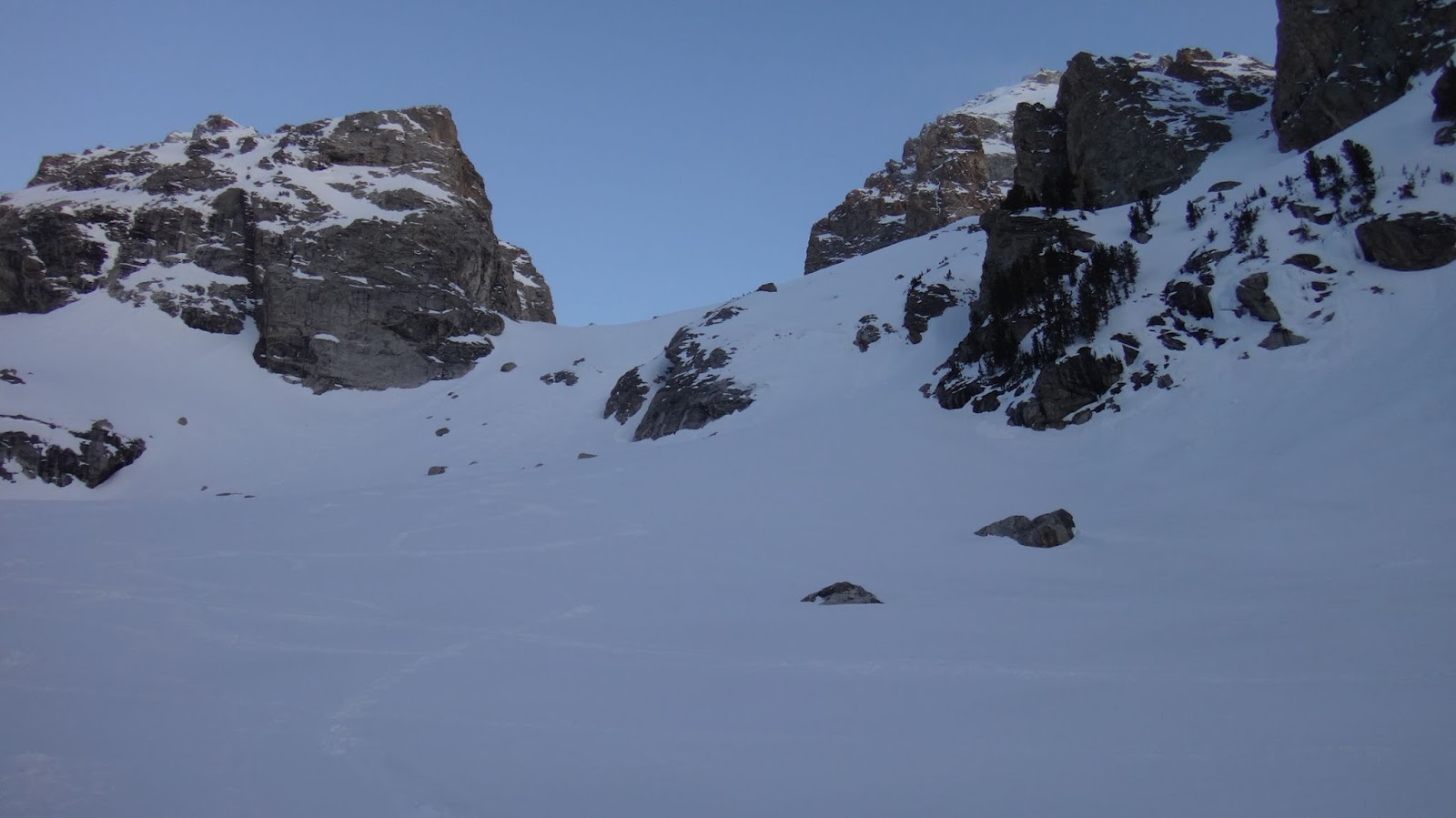
We are looking west toward the North Fork of Garnet Canyon & toward the Lower Saddle (unseen).

South Fork of Garnet Canyon

East Face of the Grand Teton

The bowl above the Meadows' headwall.
Looking toward the Lower Saddle (unseen).
Looking toward the Lower Saddle (unseen).

Looking back down the Meadows' headwall.
Some steeper sections are out of view.
Some steeper sections are out of view.

Looking toward the Petzoldt Caves
Camping Zone and Spalding Falls - center-left.
Camping Zone and Spalding Falls - center-left.

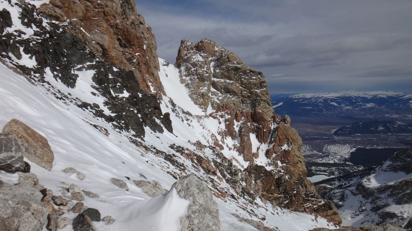
East Face of the Grand Teton with
Teepe Pillar in front.
Teepe Pillar in front.

Close-up view

Bowl above the Meadows' headwall,
& below the Grand Teton.
& below the Grand Teton.

Looking E-SE.
Looking back down the bowl which is above the steeper part of the Meadows' headwall.


The Moraines leading to the Lower Saddle.
Looking W-NW
Looking W-NW

Looking back from the base
of the Middle Teton Glacier.
of the Middle Teton Glacier.
We are looking toward the Morainal Camping Zone (left) and down the North Fork of Garnet Canyon.

Lower Saddle's headwall

Middle Teton Glacier

Skiers coming off the Lower Saddle.

....and a snowboarder.

Lower Saddle. Looking S-SW.

The wind was roaring at about 40 mph.
It died down to a whimper as
we got above the saddle.
Looking northish.
It died down to a whimper as
we got above the saddle.
Looking northish.

Dartmouth Basin - west side of the Lower Saddle.
Looking southwest.


Looking southwest.


Looking southish.
The Eye of the Needle, 'Belly Roll Almost', Chockstone Chimney, Briggs' Slab, & Cracks of Death area.

We used the Briggs' Slab. Looking west.

Briggs Slab area.
Looking northish.

Looking northish.

Looking back southish.
We are on the Central Rib's Bench.
We are on the Central Rib's Bench.

Looking S-SE.
 Looking east at the Central Rib's two
crossovers to Wall Street (Upper Exum Route).

crossovers to Wall Street (Upper Exum Route).
We almost always take the Lower Crossover. If we are running laps on the Upper Exum and we don't take the Wall Street Couloir back down to Wall Street then we will crossover at the Upper Crossover.

Three skiers on the summit of the Middle Teton.

...skiers on MT.

Plenty of unstable snow above here.
We headed for the CR and avoided the drainage.
We headed for the CR and avoided the drainage.

Approach to the Upper Saddle.
Looking NE.
Looking NE.
This snow was poorly bonded and required a little extra care to traverse.

The patio covered in snow.
This is just below the Upper Saddle.
Wall Street can be seen at center-left.
This is just below the Upper Saddle.
Wall Street can be seen at center-left.

The Middle Teton and everything south.

View toward the Town of Jackson.
Looking S-SE.
Looking S-SE.

Looking back toward the Lower Saddle and the Patio.
Looking southish.
Looking southish.

We took the WHITE route up.
Looking easterly.
Looking easterly.
The BLUE route is the most common summer route to reach the upper part of the Upper Saddle. We took the RED route on the way down. This is the view from the lower western side of the Upper Saddle.

A shot down at Wall Street

Jackson Lake.
Seen from the lower part of the Upper Saddle.
Looking N-NE.
Seen from the lower part of the Upper Saddle.
Looking N-NE.

...ditto

Cascade Canyon. Looking N-NW.


The Enclosure. Looking west.
 Click to enlarge
 Overview of the Owen-Spalding Route


Looking toward the OS's Belly Roll.
This is the NE corner of the Upper Saddle.
 Looking back toward the Upper Saddle
... and the Belly Roll.
Looking S-SW.
This is the NE corner of the Upper Saddle.
... and the Belly Roll.
Looking S-SW.
The Black Ice Couloir is the big drop on the north aspect of the Upper Saddle.


Looking at the Crawl (right) and
the access to the Double Chimney (center).
Looking N-NE.
the access to the Double Chimney (center).
Looking N-NE.

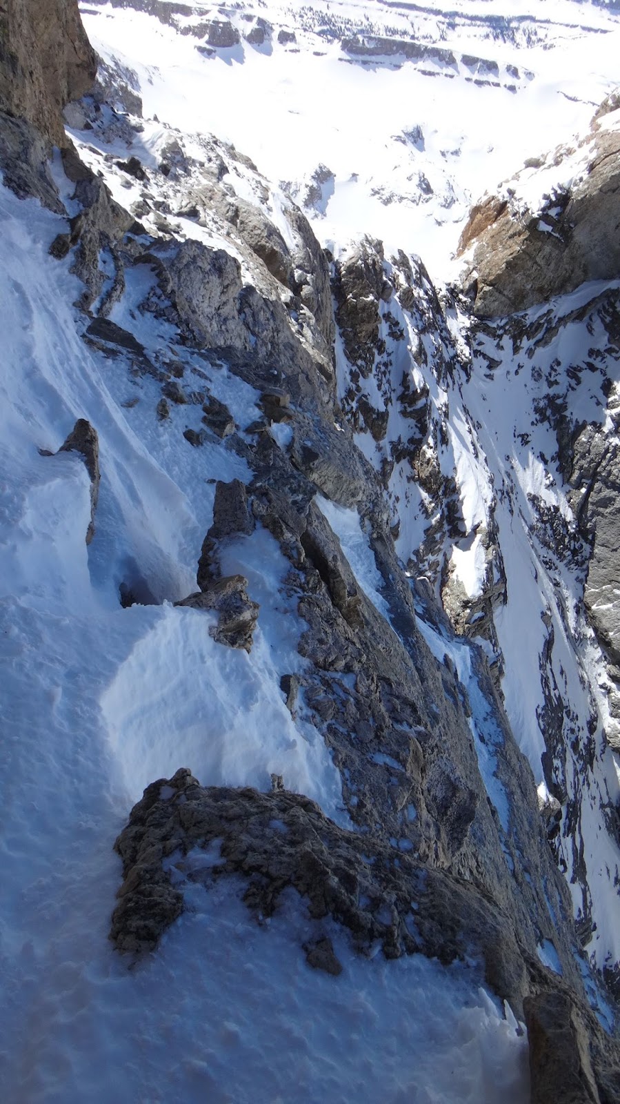
Looking down from the First Entrance
of the Double Chimney (the crux).
Looking westerly.
With snow as a 'step', it's easier to ascend.
of the Double Chimney (the crux).
Looking westerly.
With snow as a 'step', it's easier to ascend.

Middle of the Double Chimney.
Looking easterly.
Looking easterly.

Looking back down the
Double Chimney's Open-'V'
Double Chimney's Open-'V'

Looking east toward the bottom
of the Owen Chimney
of the Owen Chimney

Looking SE at the scramble toward the Catwalk.
You can also reach the Catwalk from the Owen Chimney.
You can also reach the Catwalk from the Owen Chimney.

Looking at the first 'opening' in the Owen Chimney.
Looking NW.
It's from here that you can access the Catwalk or the O-C Bypass Crack.
Looking NW.
It's from here that you can access the Catwalk or the O-C Bypass Crack.

Mostly dry Owen Chimney...
except at very top which had snow.
except at very top which had snow.

Catwalk. Looking southish.

The scramble off the Catwalk
and toward the Main Rap Overlook.
Looking SE.
That little hump at the top-center of the photo is the Main Rap Overlook.
and toward the Main Rap Overlook.
Looking SE.
That little hump at the top-center of the photo is the Main Rap Overlook.

Looking N-NE.

View toward Sargent's Chimney - center left.
Seen from the Main Rappel Overlook
Looking E-NE.
Seen from the Main Rappel Overlook
Looking E-NE.

Main Rap as seen from the Rap Overlook.
Looking S-SE.
Looking S-SE.

View toward Sargent's.

Main Rap to Upper Saddle.
The green dots are one way to access the 2x70' alternate rap area. We put those green dot on too steep of a angle once you leave the access chimney. It's actually slightly uphill from the access chimney.

Looking back toward the Upper and
Lower Saddles from the Main Rap Overlook.
Lower Saddles from the Main Rap Overlook.

View back toward Catwalk.

Green dots are scramble/climb to
the Main Rappel Overlook from the Catwalk.
Red dots are Catwalk.
the Main Rappel Overlook from the Catwalk.
Red dots are Catwalk.

Cascade Canyon

Enclosure

Sargent's Chimney.

Looking N-NE

Looking S-SW from the ledge at
the base of Sargent's Chimney.
the base of Sargent's Chimney.

The ledge at the base of Sargent's.

of the way up of Sargent's Chimney.
Looking NW.

...same location but view SW.

...same location but view NE.

This was shot from the top of the
alternate exit from Sargent's Chimney.
The Hidden Exit.
View W-NW.
alternate exit from Sargent's Chimney.
The Hidden Exit.
View W-NW.

Sargent's Rap - top of Sargent's Chimney.
View southish.
Sargent's rap is about 20' south
of the exit from the Hidden Exit.
View southish.
Sargent's rap is about 20' south
of the exit from the Hidden Exit.

It's a straight shot to the summit...
but climbers will often zig-zag their way up.
View E-NE.
but climbers will often zig-zag their way up.
View E-NE.

The Slabby Wall. View E-NE.
The Center Crack points toward the summit and back toward Sargent's Hidden Exit. The Center Crack is a very easy climb but we took the 'switchback' variation.

Slabby Wall.
Looking NE at it's profile from the 'switchback'.
Looking NE at it's profile from the 'switchback'.

Ledge above Slabby Wall.
Looking SW.
This is part of a 'switchback' if you
don't climb directly up the wall.
Looking SW.
This is part of a 'switchback' if you
don't climb directly up the wall.

View toward summit from just
above Slabby Wall. Looking NE.
above Slabby Wall. Looking NE.
On your way down from the summit, remember that you are going to be directly under the Horse and directly above the Slabby Wall to access the small 'switchback' ledge.

View from the summit. Looking south.

Looking S-SE.


Ford Couloir


Teewinot

East Ridge

Mt. Moran


Double Chimney's Second Entrance.

Belly Roll

...ditto

Upper Saddle - looking S-SW.


View of the rappel area at the Upper Saddle.

Exit off the US.

Exum Gully - the drop off the Upper Saddle's southeastern side.

Our footprints along the Upper Saddle. Looking SW.


Looking S-SE.

View down the Owen-Spalding Couloir.
Looking southish.
Looking southish.
This is the main drainage on the western side of the Central Rib. The Upper Western Rib is to the west of the drainage (center-right). On the western side of the UWR is the Dartmouth Couloir.

Access to the Black Rock Chimney - far right.
A drainage to the Wall Street Couloir is at the far left.
Looking SE.
A drainage to the Wall Street Couloir is at the far left.
Looking SE.

View from the very bottom of
the BRC toward the SW.
We are on the Central Rib's Bench.
the BRC toward the SW.
We are on the Central Rib's Bench.


Crossovers to Wall Street along the Central Rib.
The 'backside' of the Needle is at the lower right.
The 'backside' of the Needle is at the lower right.


The Black Dike, and the Needle at
the base of the Central Rib.
the base of the Central Rib.


Red Rock Rib covered in snow

Dartmouth Basin

Lower Saddle

North Fork of Garnet Canyon. Bradley Lake far below.

Looking back west toward the Middle Teton.

Garnet Creek melting off.

Skin track on the southern side of Garnet Creek.

Bradley lake

Ski tracks across the lake.

We took the lake crossing.

The approach is melting off at a good clip.

Lunch at the Lower Saddle.
Enjoy Safe Climbing
A few trip reports for April through October
July 17th, 2016 (UXM) PNG Variation
Detailed Look At Specific Route Features
All images may be used without permission or attribution for all not-for-profit purposes.