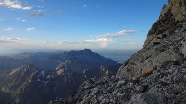
Saturday afternoon sunset hike up the Grand Teton
Saturday afternoon July 9th
Left Lupine Meadows at 4:28pm
Arrived at the summit at 8:42pm
4 hours 14 min walking at a fast clip.

Lupine Meadows Trailhead
Saturday afternoon July 9th
Left Lupine Meadows at 4:28pm
Arrived at the summit at 8:42pm
4 hours 14 min walking at a fast clip.
We stopped for about 16 minutes to take 195 photos before reaching the summit. That's 5 seconds per picture.
None was climbing Saturday evening even though it was warm and the winds were mostly calm. Several climbers were spending the night at the Lower Saddle despite the threat of bad weather. About 4 inches of snow fell between Sunday & Monday at the Lower Saddle. The rangers & the Exum guides were at their huts. We did not take an axe or crampons nor did we need them on Saturday.
None was climbing Saturday evening even though it was warm and the winds were mostly calm. Several climbers were spending the night at the Lower Saddle despite the threat of bad weather. About 4 inches of snow fell between Sunday & Monday at the Lower Saddle. The rangers & the Exum guides were at their huts. We did not take an axe or crampons nor did we need them on Saturday.

Lupine Meadows Trailhead
Looking back at the First Boulder Field.
There are many boulder fields but only two locations where the trail really disappears in boulder fields. This is the first location by the Platforms Camping Zone & Garnet Creek.
Garnet Creek & stone path
Looking back at the Meadows Camping Zone. Empty.
There are some years when the Meadows Camping Zone is completely covered in snow in July as we roll into the high season.
The Stairs. Spalding Falls in background.
The Moraines between the Middle & the Grand.
The Fixed Rope at the Lower Saddle's headwall. An auxiliary rope was placed over the snow which was slick.
Fixed Rope
Climbers headed for the Fixed Rope from the Lower Saddle.
Looking toward the Upper Saddle from the Lower Saddle
The Eye of the Needle - a natural tunnel
Looking back down the Chockstone Chimney
Access is by the Smooth Slab.
Looking over at the main drainage by the Upper Western Rib. View from the Central Rib by the Smooth Slab - see above.
Looking back at the Central Rib's Bench (it slopes but sits above the drainage to the west).
Central Rib - left side. MT background.
Access to the Central Rib's Black Rock Chimney
CR's Black Rock Chimney
Black Rock Chimney
Upper exit from the Black Rock Chimney
Wall Street as seen after exiting the BRC
CR's Black Rock Chimney - upper access
Central Rib - on right
Wall Street Couloir at far right
Access to the upper eastern side of the Upper Saddle. This is along the southern exposure above the Exum Gully (WS Couloir)
Looking up at the Main Rappel to the Upper Saddle
Cascade Canyon
View from the bottom of the Main Rap area
Access to the Belly Roll at the NE corner of the Upper Saddle
Belly Roll
Ledge between Belly Roll & The Crawl
View toward the Crawl
Double Chimney access
Northern side of the Upper Saddle
Double Chimney access area
Crawl
1st Entrance of the Double Chimney
Looking back at The Crawl
2nd Entrance of the Double Chimney
2nd Entrance at far left
Looking down the 2nd Entrance
Middle of the DC. The tunnel variation and the Open-'V'. Still icy in the tunnel.
Tunnel - usually considered the easier variation when dry.
Stemming to access the Open-'V'
There are many variations in the DC.
View from the exit of the DC
View toward the Owen Chimney from the DC
Owen Chimney
We took the Catwalk on the way up. We downclimbed the Owen Chimney on the way down.
The two ways to access the Catwalk
OC Bypass Chimney / Crack
Catwalk - looking southish
Running water on the Catwalk
Catwalk looking back to the N-NE
Looking E-NE toward Sargent's Chimney from the Main Rap Overlook.
Main Rap Overlook
Main Rap area
Looking back toward the Main Rap area from the base of Sargent's
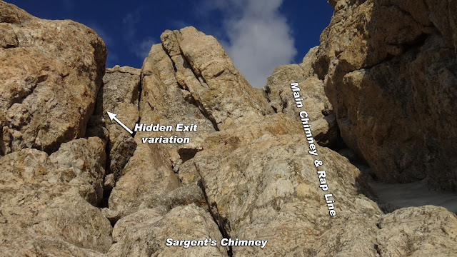
Looking up Sargent's Chimney
Sargent's alternative exit
Corner Crack at the Hidden Exit
Just above the Corner Crack & part of the Hidden Exit route
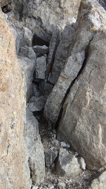
Another corner crack in the chute to exit the Hidden Exit. See below.
Walk a few feet to the south and you'll be at the top of Sargent's main chimney after exiting the alternate route out of Sargent's Chimney
It's mostly a straight shot to the summit after Sargent's but many climbers zig-zag their way around the rock
Climb the Center Crack or 'switchback' to the SE and then NE to bypass the Slabby Wall.
'Switchback' scramble to the SE to bypass the Slabby Wall
Slabby Wall
Ledge above Slabby Wall
Just below the summit which is to the NE of the Slabby Wall.
East Ridge
Descent via the Owen Chimney on the way back down........
Owen Chimney
Owen Chimney
Near the bottom of the Owen Chimney
Water refill at the Lower Saddle.
A few trip reports for April through October
July 17th, 2016 (UXM) PNG Variation
Detailed Look At Specific Route Features
All images may be used without permission or attribution for all not-for-profit purposes.
Enjoy Safe Climbing


